

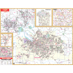
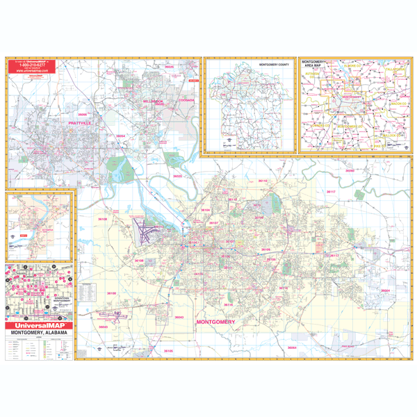
The 4th edition Wall Map of Montgomery, Alabama and adjacent offers up-to-date cartography in complete street detail with new streets. Printed in color on a laminated surface making it both markable and washable. Street indexing in a separate book. Measures 64" x 54" at a scale of 1” = 2,000 feet.
Area of coverage ranges: North: to include all of the city of Millbrook; South: to the city limits of Montgomery including I-65 exit #164; East: to Pike Road; West: to include the city of Prattville. Insets: the city of Wetumpka in Elmore County, Montgomery County area map (scale of 1” – 2.5 mi.), and a Downtown Montgomery enlargement.
Details, data, and information are as follows: all streets, post offices, hospitals, railroads, mileage circles, ZIP code boundaries, airports, cemeteries, shopping centers, water features, recreational parks, city limits and annexations, government buildings, fire and police stations, educational facilities, golf and country clubs, longitude/latitude, and points of interest.
Framing rails are included on top and bottom for easy wall mounting.