

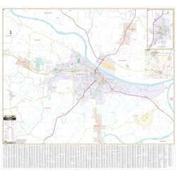
Jefferson City & Fulton County, MO Wall Map
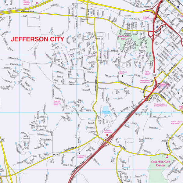
Regular price $199.95Our Jefferson City and Fulton Co, MO Wall Map, with adjacent areas, measures 60" x 58" (5' W x 4'10" H) and features up-to-date cartography, with new streets and changes in complete street detail; is printed in color, with a markable and washable laminated surface; and offers a street index printed on the map.
The area of coverage includes the following boundaries:
- North to Holts Summit, in Callaway County
- South to Wardsville
- East to the Osage River and Taos
- West to Lohman
The Jefferson City and Fulton Co, MO Wall Map also includes a loacl area map and an inset of Fulton.
Details and features include:
- AIRPORTS
- BLOCK NUMBERS
- CEMETERIES
- CITY LIMITS (color-coded)
- EDUCATIONAL INSTITUTIONS
- FIRE & POLICE STATIONS
- GOLF & COUNTRY CLUBS
- GOVERNMENT BUILDINGS
- HOSPITALS
- LIBRARIES
- POINTS OF INTEREST
- POST OFFICES
- RAILROADS
- RECREATIONAL PARKS
- SECTION, TOWNSHIP & RANGE LINES
- SHOPPING CENTERS
- STREETS & HIGHWAYS
- WATER FEATURES
- ZIP CODE BOUNDARIES
Framing rails are included, top and bottom, for easy wall mounting.
|
Product #: 2385628 |
|
Dimensions: Width 60, Height 58 |
|
Weight: 9.00 |