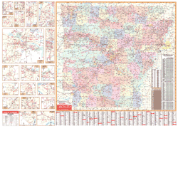
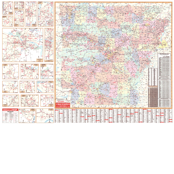
The 2nd edition Arkansas State Wall Map is published by Universal Map. Measures 50” W x 66” H with a laminated, markable, and washable surface. Printed on a scale of 1” = 6.5 miles. Indexed on the map’s face. Provides color-coded counties, a mileage chart between major cities, and framing rails mounted top and bottom.
Inset maps: Blytheville, Camden, Conway, El Dorado, Fayetteville, Fort Smith, Helena, Hot Springs, Jacksonville, Jonesboro, Little Rock, Paragould, Pine Bluff, Rogers, Russellville, Springdale, Texarkana, and West Memphis.
Other features include all state and federal highways, major waterways, state universities, military installations, airports, hospitals, state and national parks, points of interest, cities and towns complete with populations, wildlife areas, and rest areas.
Framing rails are included on top and bottom for easy wall mounting.