

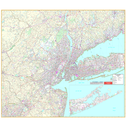
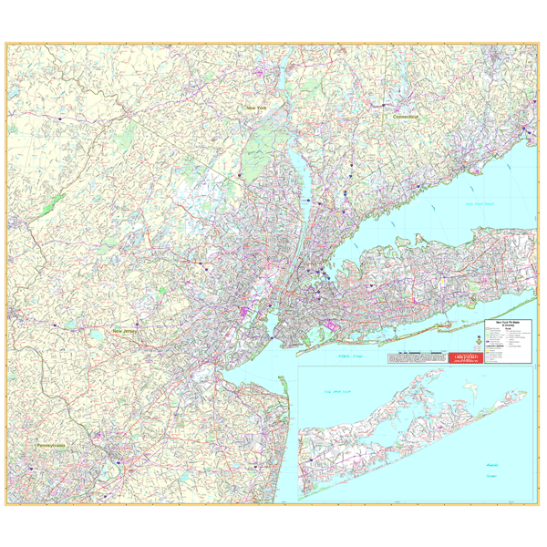
The 1st edition Wall Map of New York Tri-State Vicinity includes a 60-mile radius of New York City. Measures 64 x 54 inches (5'4" W x 4'6" H) with up-to-date cartography in complete street detail at a scale of 1” = 2.05 miles. Printed in color with a markable/washable-laminated surface. Cities indexed in a separate book. Includes hanging rails mounted top and bottom.
Area of coverage: New York: five Boroughs, Nassau, Suffolk, Westchester, Putnam, Rockland, Orange, and portions of Duchess & Ulster; Connecticut: all of Fairfield County and portions of New Haven and Litchfield Counties; New Jersey: Bergen, Essex, Hudson, Hunterdon, Somerset, Morris, Passaic, Sussex, Warren, Mercer, Middlesex, Monmouth, and portions of Ocean and Burlington Counties; North: to Waterbury in CT, Newburgh, & Middletown in NY; South: to Point Pleasant in Ocean County, NJ and Philadelphia, PA; East: to Montauk Point in NY, New Haven, & Bridgeport in CT; West: to Phillipsburg in Warren Co., NJ and Stroudsburg in Monroe Co., PA.
Details include major streets and all highways, county lines and names, mileage circles, ZIP codes and boundaries, airports and parks, water features, longitude and latitude lines.