

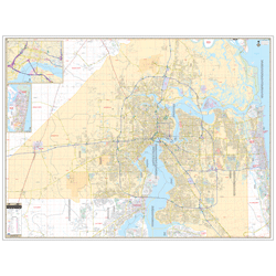
Jacksonville & Duval County, FL Wall Map
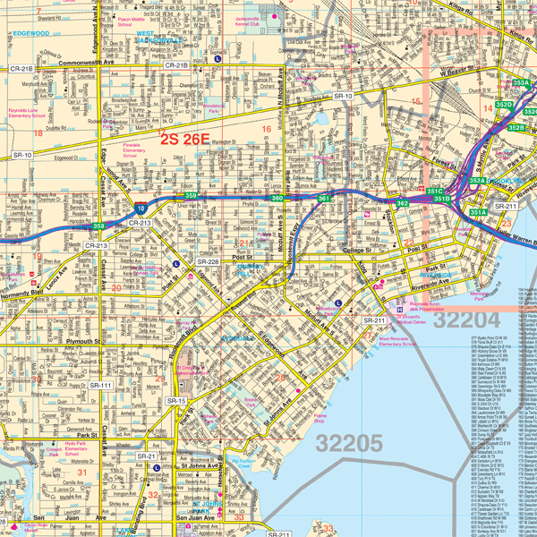
Regular price $199.95Our Jacksonville and Duval County, FL Wall Map, with adjacent areas, measures 78" x 59" (6'6" W x 4'11" H) and features up-to-date cartography, with new streets and changes in complete street detail; is printed in color, with a markable and washable laminated surface; and offers a street index in a separate book-format.
The area of coverage includes all of Jacksonville and Duval County, with the following boundaries:
- North to the Nassau-Duval County line
- South to Orange Park, Doctor's Inlet, and Fruit Cove and Ponte Vedra, in St. John's County
- East to the Atlantic Ocean
- West to the Baker-Duval County line
The Jacksonville and Duval County, FL Wall Map also includes insets of Fernandina Beach and Downtown Jacksonville.
Details and features include:
- AIRPORTS
- BLOCK NUMBERS
- CEMETERIES
- CITY LIMITS (color-coded)
- EDUCATIONAL INSTITUTIONS
- FIRE & POLICE STATIONS
- GOLF & COUNTRY CLUBS
- GOVERNMENT BUILDINGS
- HOSPITALS
- LIBRARIES
- POINTS OF INTEREST
- POST OFFICES
- RAILROADS
- RECREATIONAL PARKS
- SECTION, TOWNSHIP & RANGE LINES
- SHOPPING CENTERS
- STREETS & HIGHWAYS
- WATER FEATURES
- ZIP CODE BOUNDARIES
Framing rails are included, top and bottom, for easy wall mounting.
|
Product #: 1133233 |
|
Dimensions: Width 78, Height 59 |
|
Weight: 9.00 |