


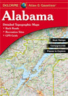
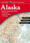
Rely on a DeLorme Atlas & Gazetteer for the utmost in trip planning and backcountry access. Contains topographic maps with unbeatable detail, plus gazetteer information on great places to go and things to do. Each atlas is a quality paperback; size 11" x 15-1/2"
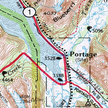
Map detail commonly includes:
» Back roads, dirt roads and trails
» Elevation contours
» Remote lakes and streams
» Boat Ramps
» Public lands for recreation
» Land use / land cover – forests, wetlands, agriculture
» Trailheads
» Campgrounds
» Prime hunting and fishing spots
Each Gazetteer entry's location is cross-referenced to the corresponding map.
| Alaska Atlas Facts | |
| Scale | 1:300,000 (1"=4.8 miles) for pp. 16-129; 1:1,400,000 (1"=22 miles) for pp. 130-141 (far northern & western AK) |
| Contour Interval | 200' or 1000', depending on scale |
| GPS | Grids & tick marks |
| Index | Placenames & physical features (lakes, rivers, mountains, etc.) |
| Street Maps | Anchorage, Fairbanks, Juneau |
| Special Features | Temperature/Precipitation/Daylight hours chart; Mileage chart; Shaded relief map of the entire state |
| Pages | 133 pp. of maps, 156 pp. in all |
| Copyright | 2010 |